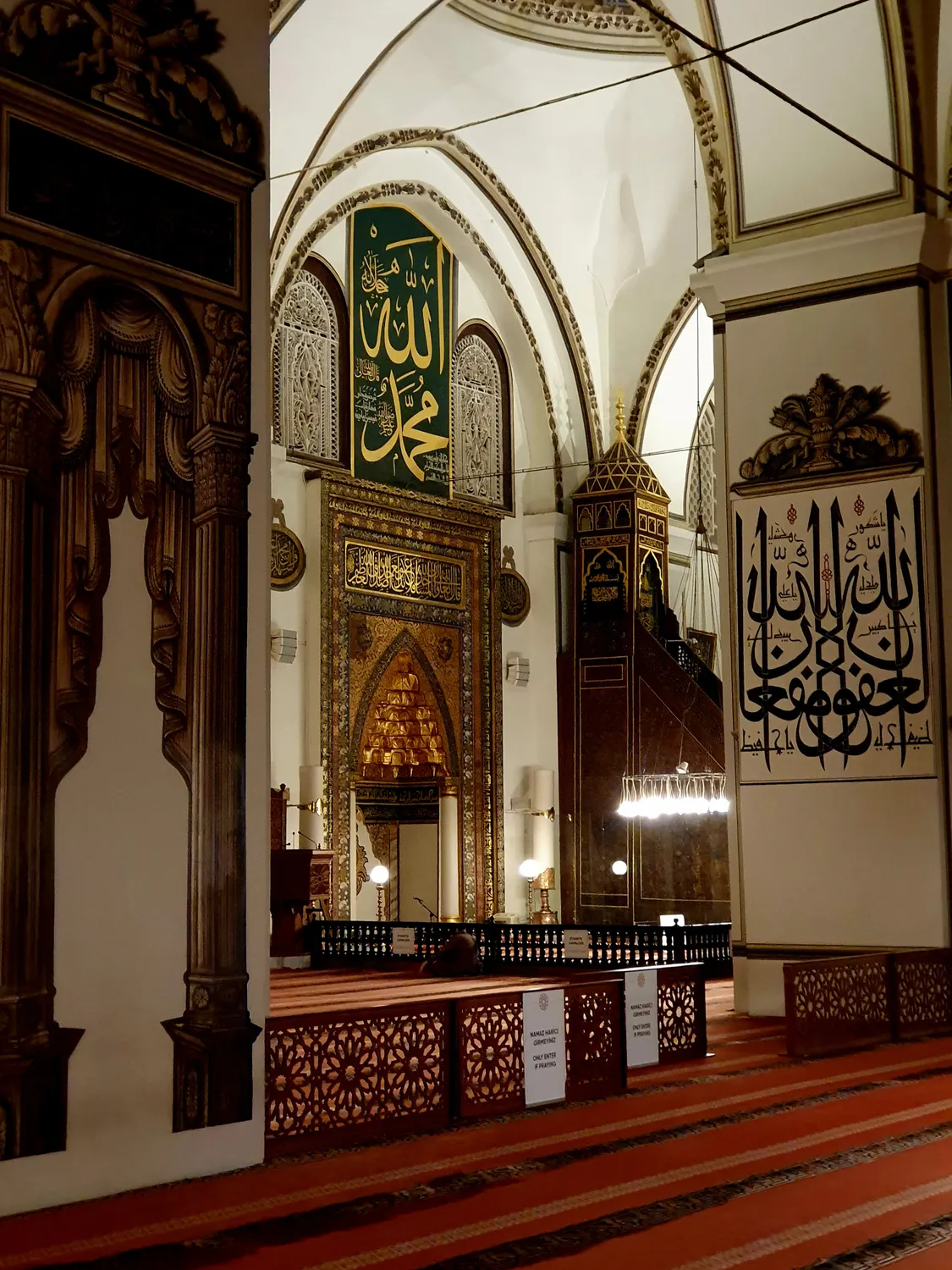
Grand Mosque of Bursa
This 14th-century mosque features twenty domes and intricate calligraphic panels decorating its interior walls.
View the minbar carvings from the center under the main dome.

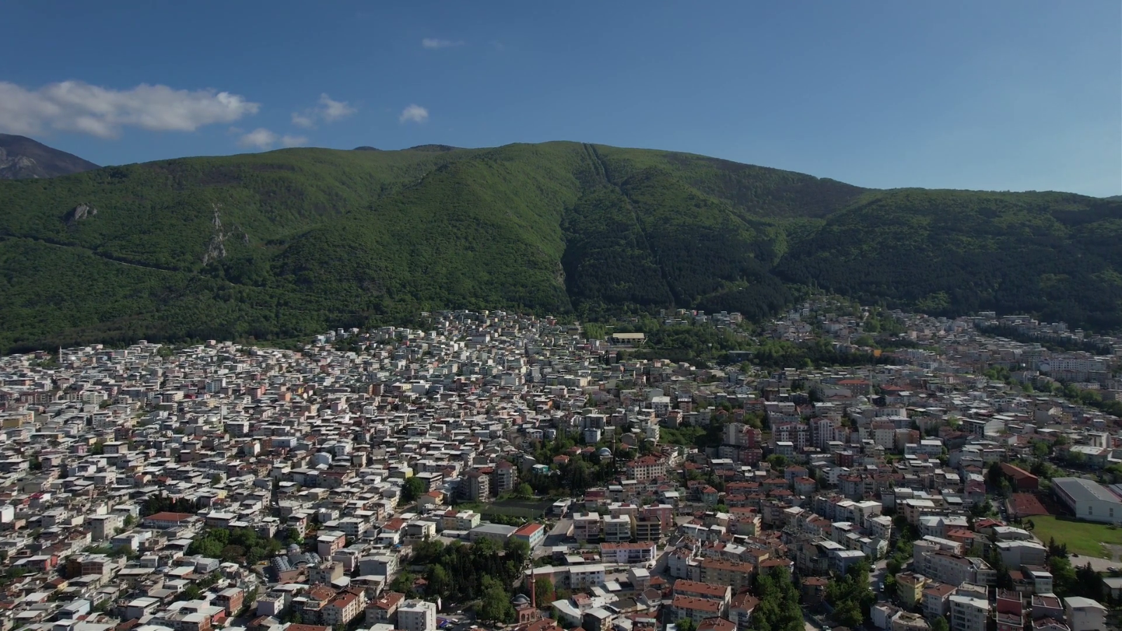
Bursa sprawls across the northwestern slopes of Uludağ, its historic core packed into a compact grid below the mountain's cable car stations. The city's Ottoman heart sits within a twenty-minute walk of modern shopping streets, thermal bath complexes, and the base terminals that climb toward alpine villages. A clear orientation framework turns a potentially confusing layout into a navigable sequence of named quarters.
Quick answer
A bursa tourist map divides the city into four practical zones: the UNESCO-inscribed historic center around Ulu Cami and the bazaar district, the Çekirge thermal quarter two kilometers west, the Tophane citadel hill overlooking the valley, and the Uludağ cable car departure zone at Teleferik. Free entry to public streets and squares means you navigate at your own pace between 09:00 and 18:00 for optimal daylight across all neighborhoods.
Bursa's street grid predates modern city planning by six centuries. The historic peninsula between Gökdere and Cilimboz streams holds the densest concentration of imperial mosques, hans, and covered markets, all within a radius compact enough that most visitors cover it on foot. The Green Mosque anchors the eastern edge, the Grand Mosque marks the commercial center, and the silk market sprawls north toward the old city walls. Each monument carries Ottoman-era street names that appear on modern wayfinding signage in both Turkish and English. The Çekirge district lies uphill to the west, historically a spa retreat now lined with mid-rise hotels and bathhouse complexes fed by geothermal springs. A single avenue connects it to the bazaar quarter, ascending through residential blocks and small parks. The Tophane citadel occupies the ridge opposite, its ramparts offering sight lines across the entire valley floor. Between these landmarks, a visitor map segments the city into walkable sections rather than requiring constant transport. Practical orientation starts at Heykel Square, the central traffic junction where intercity buses deposit passengers. From that pivot point, the historic axis runs east toward the Green Tomb and west toward Çekirge. The Uludağ cable car departs from Teleferik station, four kilometers south of the center and reachable by municipal dolmuş vans. Trail maps at the upper terminal chart alpine routes, but the lower city remains the focus for monument-touring visitors. Street markers reference both neighborhood names and major structures, a dual system that compensates for winding lanes that defeat GPS precision in the oldest quarters. Bursa's compactness rewards methodical exploration. A morning loop from Ulu Cami through the silk bazaar to Koza Han takes ninety minutes without stops. The Muradiye complex sits twenty minutes north on foot, and the thermal baths of Eski Kaplıca occupy the far western edge of the walkable zone. Digital maps layer these points onto the street grid, but printed versions remain common at hotel desks and the official tourism office on Atatürk Caddesi. The city's topography—mountain to the south, plain to the north—provides constant geographic reference. Navigation tools clarify distances and sight lines, turning a first visit into confident movement across a legible urban fabric.
“Bursa's street grid predates modern city planning by six centuries, yet the compact historic peninsula remains entirely navigable on foot.”
This route suits first-time visitors with a full day to cover Bursa's main historical districts and green spaces. Allow 7–8 hours for walking, sightseeing, and breaks.
Start at Ulu Camii in the city center, then explore Koza Han and the Covered Bazaar within walking distance. Budget 90 minutes for architecture and souvenir browsing.
Walk uphill to Tophane, the old citadel quarter, for Ottoman house architecture and panoramic views. Allow 60 minutes including the climb.
Take a dolmuş or taxi west to Çekirge, Bursa's thermal district, for lunch near the historic baths. Budget 90 minutes for the meal and a quick look at the bath exteriors.
Head east to the Yıldırım neighborhood to see the mosque, theological school, and tombs. Spend 45 minutes on this cluster of early Ottoman monuments.
Continue to Muradiye for the peaceful garden cemetery with royal tombs and a small museum. Allow 60 minutes to walk the grounds.
If time permits, travel to Teferrüç for views of the cable car station and foothills. This adds 45 minutes including transport.
Bursa's central historical district is efficiently accessed via the Bursaray metro line and a comprehensive bus network that connects major city hubs. Navigating to sites via your Bursa tourist map is straightforward using these primary transit arteries.
Bursaray Line 1 or 2 to Şehreküstü or Osmangazi stations
Various lines to Heykel or Ulu Cami stops
Direct transit via D200/D575 highways
Central district walking routes from main transit hubs
For optimal exploration and navigation of historical sites, the best arrival window is 09:00–18:00. Arriving within this timeframe ensures full access to local public transport services and maximum daylight for site orientation.
The Bursa tourist map centers on a collection of UNESCO-listed structures and historic neighborhoods that illustrate the city's role as the first capital of the Ottoman Empire. These landmarks represent the core architectural and cultural heritage found within the city limits.
This 14th-century mosque features twenty domes and intricate calligraphic panels decorating its interior walls.
View the minbar carvings from the center under the main dome.
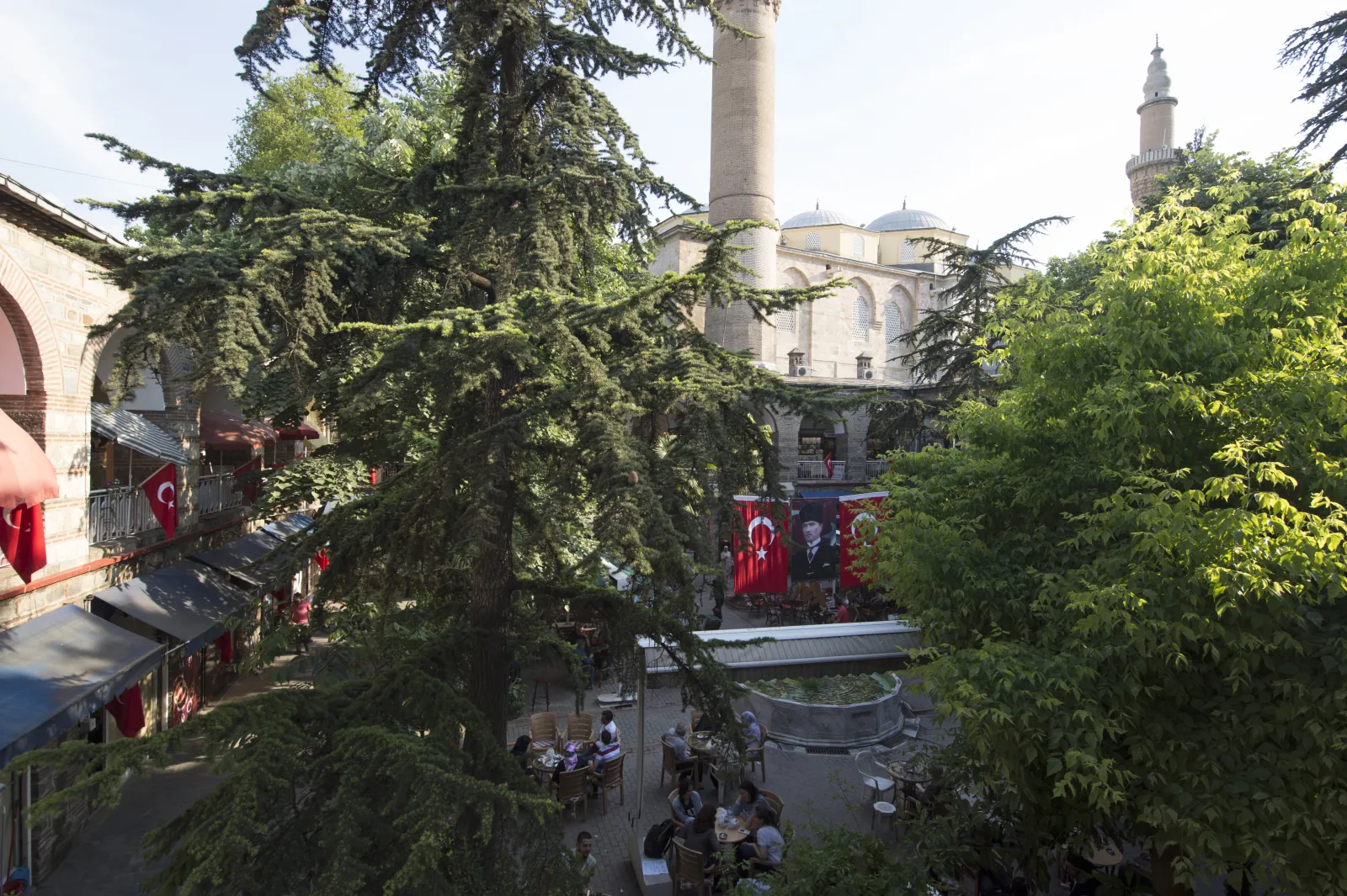
Built in 1491, this historic silk market served as a vital hub for the international silk trade.
Visit the upper floor balcony for a view of the courtyard.
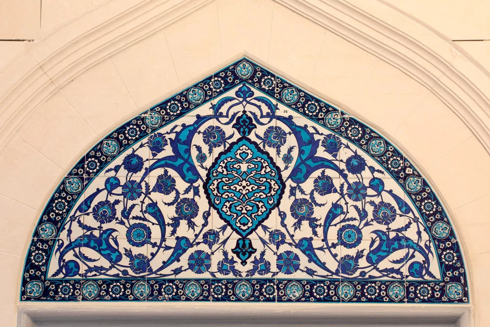
Known for its green-tiled interior, this building reflects early Ottoman decorative arts and tile work.
Observe the mihrab details from the entrance area.
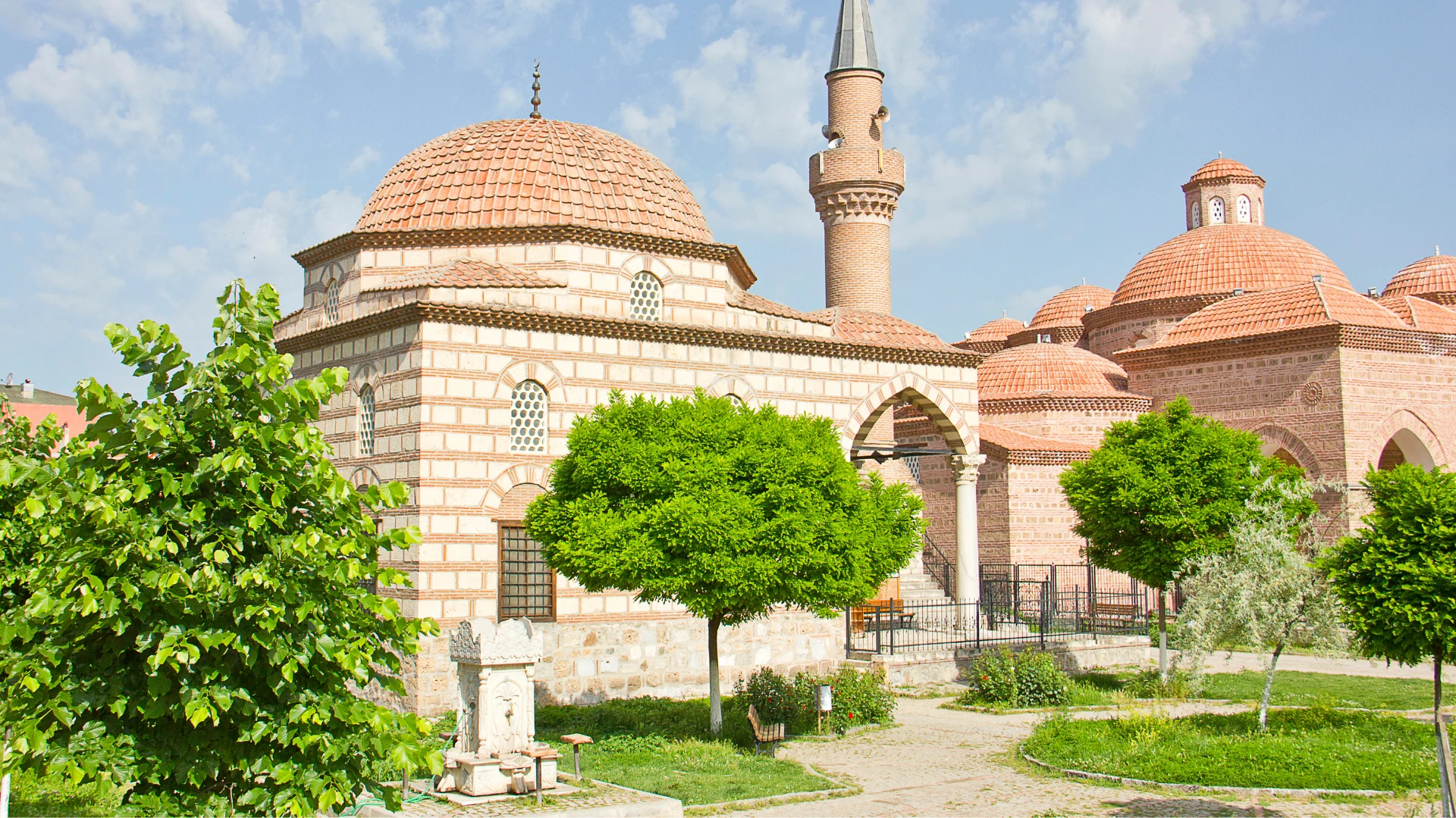
This site houses a collection of royal tombs set within a peaceful garden environment.
Walk through the garden to compare the different tomb architectures.
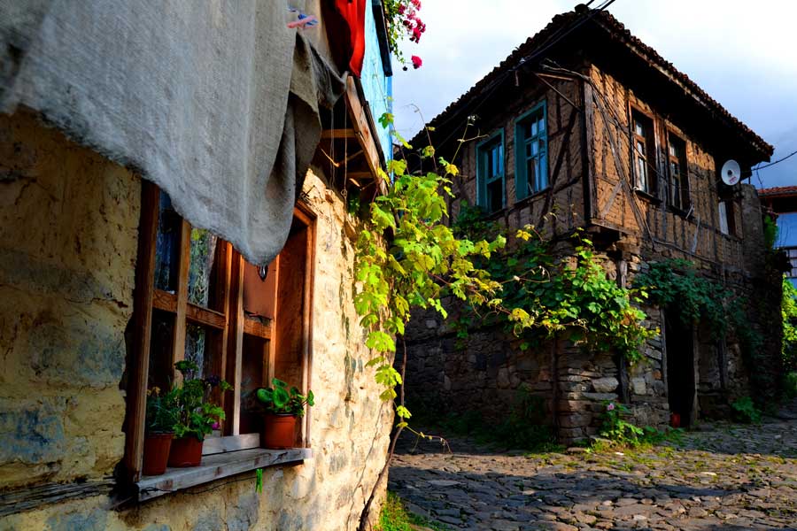
This historic village preserves traditional Ottoman-era timber-framed houses and cobblestone streets.
Walk the uphill paths early to photograph architecture without crowds.
The best arrival window is 09:00–18:00, providing optimal daylight for city exploration and navigating historical sites. Visiting during mid-spring or early autumn offers the most temperate conditions for walking the city.
Mild, 15°C to 22°C. Ideal for outdoor walking and garden visits.
Warm and dry, 25°C to 30°C. Popular period for local festivals and mountain access.
Cooling temperatures, 18°C to 24°C. Stable weather conditions suitable for city tours.
—;Best time to navigate historical sites with fewer pedestrians.
Verdict: The best time to follow the Bursa tourist map is Tuesday to Thursday between 09:00 and 18:00 during the months of April or October.
The sites represented on the Bursa tourist map remain accessible throughout the week. Visitors can explore these locations at any time.
Admission to the historical sites featured on the Bursa tourist map is generally accessible to the public. Costs for individual attractions depend on their specific status as municipal or private entities.
Verdict: A typical adult pays 0 TRY for entry to these sites, as most historical locations managed by the city do not charge an admission fee.
Everything you need to know about bursa tourist map
You can typically find a printed bursa tourist map at the official tourism information offices located throughout the city. Digital versions are also available for download via the official city portal to help you plan your route.
A well-designed Bursa city guide is highly effective for locating historical sites and navigating the winding streets of the old districts. It provides essential context for landmarks like the Grand Mosque and Silk Market.
A standard Bursa sightseeing map highlights major mosques, Ottoman-era tombs, traditional bazaars, and scenic parks. It often includes key transportation routes to help you move between the city center and mountain cable car stations.
Yes, you can access a digital Bursa area map through the official tourism website at https://bursatanitim.gov.tr. These resources are updated regularly to reflect current city developments and infrastructure.
There is no cost to acquire or view the bursa tourist map. Information and map resources are provided as a public service to visitors exploring the region.
Using a Bursa landmarks guide is an excellent way to organize a family-friendly itinerary, as it allows you to identify accessible parks and pedestrian-friendly areas. Having a clear plan helps minimize fatigue when moving between historical sites with younger travelers.